$131.45
The Virginia Celebration Scarf was designed by Virginia Dames Harding Coughter and Molly Jordan Carey.
At 48” x 78” this scrumptious tissue cashmere shawl has so many possibilities for wear!
Click Here to see the video on The Celebration Shawl
Click Here to see The Virginia Scarf.
Tax and shipping included in price.
Only 18 left in stock (can be backordered)
Description
History behind the maps – Celebration Shawl
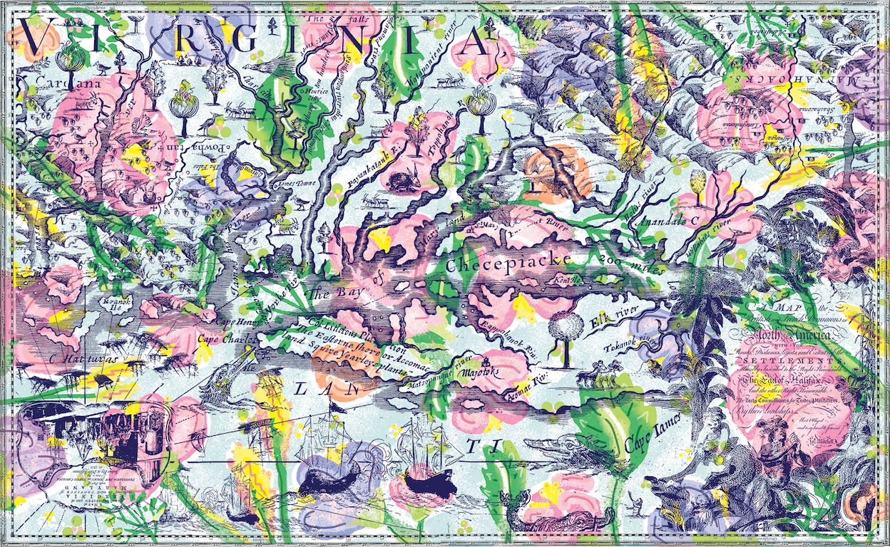
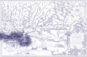
Map 1: The base map is titled: A mapp of Virginia discovered to ye hills, and in it’s latt. from 35 deg. & 1/2 neer Florida to 41 deg. bounds of New England and was produced by John Ferrar in 1650.
The map is notable for several reasons:
* His daughter Virginia issued the map and assisted in later edits as one of the first female cartographers.
* “Its north/south orientation depicting North America as a narrow continent with access to the China Sea through the Hudson River.”1
* “It erroneously reflected widely held beliefs of the day indicating easy access to China, the Indies and the silk/tea trade that the English and western Europeans so desired.” 1
* The depiction of a sassafras tree on the now Virginia Eastern Shore. Sassafras became a major commodity of trade in the new world, including Virginia, because of its medicinal properties in healing a variety of ailments. 1 https://teva.contentdm.oclc.org/digital/collection/p15138coll23/id/8602
(Map Courtesy of the Virginia Museum of History and Culture, Richmond)
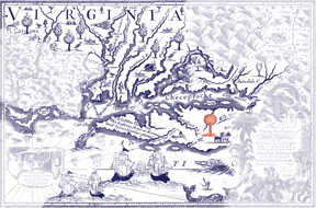
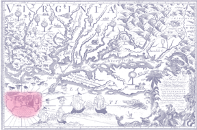
Map 2: The stylized mountain images are from: Nova Virginiae tabula published in 1630/31 by Hendrick Hondius. This map is based on John Smith’s 1608 map of the Chesapeake Bay and upgrades it by identifying the coastlines that Smith had imprecisely depicted.
(Map Courtesy of the Virginia Museum of History and Culture, Richmond)
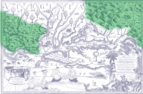
Map 3: The fanciful title cartouche designed with wheat, beaver, two Native American figures and angels is from: A map of the British and French dominions in North America, with the roads, distances, limits, and extent of the settlements, humbly inscribed to the Right Honourable the Earl of
Halifax, and the other Right Honourable the Lords Commissioners for Trade & Plantations.
This map was published by John Mitchell, a Virginian, in 1755 by Act of Parliament and is “widely regarded as the most important map in American history. Produced just before the French & Indian War it was the second large format map of North America printed by the British and was the most up to date map of its time. Over the next two hundred years, it played a significant role in the resolution of every significant dispute involving the northern border of the then British Colonies and in the definition of the borders of the new United States of America.” 1
1 https://www.raremaps.com/gallery/detail/63279/a-map-of-the-british-and-french-dominions-in-north-america-mitchell
(Map Courtesy of The Library of Congress, Geography & Map Division, Louisiana: European Explorations and the Louisiana Purchase, contents of which are in the public domain)
 Map 4: The ship-wrecked and sailing ship images are from: To His Excellency Gen Washington Commander in Chief of the Armies of the United States of America. This Plan of the investment of York and Gloucester has been surveyed and laid down, and is most humbly dedicated by his Excellencys Obedient and very humble servant, Sebastn. Bauman Major of the New York or 2nd Regt of Artillery. “Published in Philadelphia in 1782 by Sebastian Bauman, a prominent American artillery commander who surveyed the battlefield just days after Cornwallis’s surrender, it depicts the first large-scale battle plan published in the United States. It is a profoundly competent and informative depiction, executed by a highly-trained Continental engineer in the American service.” 1
1 https://bostonraremaps.com/inventory/sebastian-bauman-map-yorktown/
(Map Courtesy of The Virginia Museum of History and Culture, Richmond)
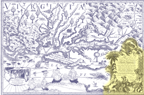
Map 5: The Virginia and Maryland title cartouche is from: A Map of the Inhabited Part of Virginia Containing the whole Province of Maryland, with Part of Pensilvania, New Jersey and North Carolina and is known as The Fry-Jefferson map. First published in 1753 by Joshua Fry and Peter Jefferson, it became the definitive map of Virginia in the eighteenth century by accurately depicting the entire Virginia river system and the Appalachian Mountains for the first time.
(Map Courtesy of The NSCDA-VA/Wilton House Museum, Richmond)
The Virginia Celebration Scarf was designed by Virginia Dames
Harding Coughter and Molly Jordan Carey
Good Morning Martha, The Celebration Shawl is 48” x 78” and is made of tissue cashmere.